


Cunningham Voting District, Fluvanna County, Virginia
About
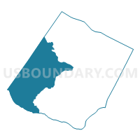
Outline

Summary
| Unique Area Identifier | 681676 |
| Name | Cunningham Voting District |
| County | Fluvanna County |
| State | Virginia |
| Area (square miles) | 70.77 |
| Land Area (square miles) | 69.68 |
| Water Area (square miles) | 1.09 |
| % of Land Area | 98.47 |
| % of Water Area | 1.53 |
| Latitude of the Internal Point | 37.83192730 |
| Longtitude of the Internal Point | -78.38183410 |
Maps


Graphs
Select a template below for downloading or customizing gragh for Cunningham Voting District, Fluvanna County, Virginia


Neighbors
Neighoring Voting District (by Name) Neighboring Voting District on the Map
- Fork Union Voting District, Fluvanna County, VA
- Monticello Voting District, Albemarle County, VA
- Palmyra Voting District, Fluvanna County, VA
- Rivanna Voting District, Fluvanna County, VA
- Rivanna 2 Voting District, Fluvanna County, VA
- Scottsville Voting District, Albemarle County, VA
- Slate River Voting District, Buckingham County, VA
- Stone Robinson Voting District, Albemarle County, VA
Top 10 Neighboring County Subdivision (by Population) Neighboring County Subdivision on the Map
- Scottsville district, Albemarle County, VA (19,063)
- Rivanna district, Fluvanna County, VA (9,540)
- Cunningham district, Fluvanna County, VA (4,526)
- Palmyra district, Fluvanna County, VA (4,394)
- Fork Union district, Fluvanna County, VA (3,366)
- District 6, Buckingham County, VA (2,921)
Top 10 Neighboring Place (by Population) Neighboring Place on the Map
Top 10 Neighboring Unified School District (by Population) Neighboring Unified School District on the Map
- Albemarle County Public Schools, VA (98,970)
- Fluvanna County Public Schools, VA (25,691)
- Buckingham County Public Schools, VA (17,146)
Top 10 Neighboring State Legislative District Lower Chamber (by Population) Neighboring State Legislative District Lower Chamber on the Map
Top 10 Neighboring State Legislative District Upper Chamber (by Population) Neighboring State Legislative District Upper Chamber on the Map
Top 10 Neighboring 111th Congressional District (by Population) Neighboring 111th Congressional District on the Map
Top 10 Neighboring Census Tract (by Population) Neighboring Census Tract on the Map
- Census Tract 201.02, Fluvanna County, VA (9,341)
- Census Tract 201.01, Fluvanna County, VA (5,571)
- Census Tract 202, Fluvanna County, VA (5,468)
- Census Tract 113.01, Albemarle County, VA (5,390)
- Census Tract 203, Fluvanna County, VA (5,311)
- Census Tract 114, Albemarle County, VA (4,351)
- Census Tract 9301.01, Buckingham County, VA (3,945)
- Census Tract 104.02, Albemarle County, VA (3,314)